
On this survey, we use two radar systems designed and built by the University of Kansas, Center for Remote Sensing and Integrated Systems (KU/CReSIS) on the Kenn Borek Twin Otter aircraft to measure internal geometry of the ice sheets. While these types of measurements prove to be very useful for glaciologists and ice sheet modelers, they are also difficult to acquire in that they cannot be achieved from satellite-based observations and thus the require airborne surveys in these harsh polar environments. The two KU radar systems used for this expedition include a radar depth sounder (RDS) and a snow accumulation radar (Snow). The systems measure the ice sheet structure through the propagation and reflections of electromagnetic waves in the ice, but for theses systems this occurs at two very different frequency bands to detect two very different characteristics of the ice: (1) the deep ice structure and bedrock topography deep below the ice sheet and (2) the thinner snow accumulation layers at the surface.
The Radar Depth Sounder (RDS).
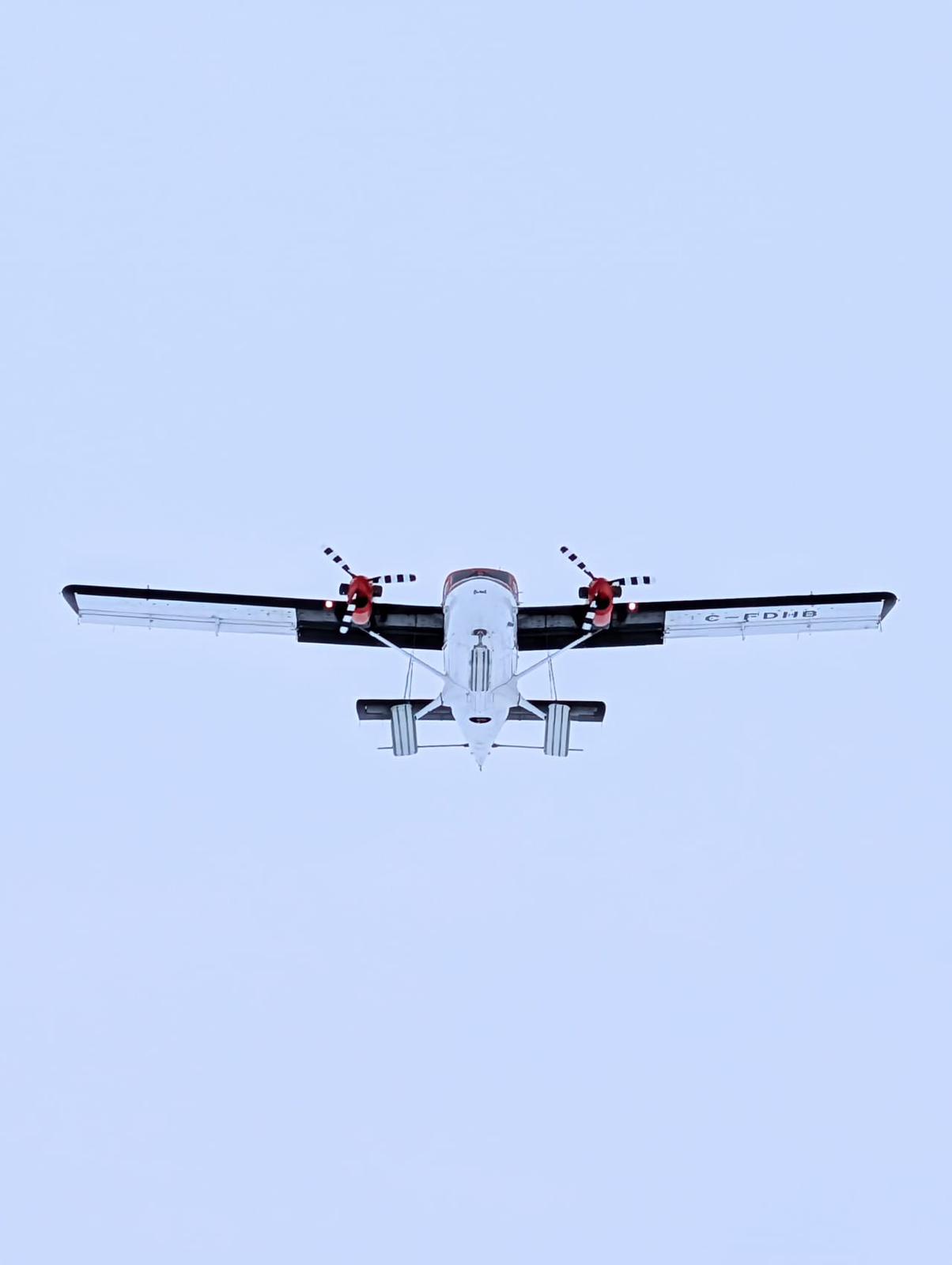
The Twin Otter RDS operates near 30-MHz using a long 5-m dipole antenna which is attached through a structural hole that extends through the aircraft tail. The radar waveform generator and 1-kW power amplifier work together to produce a high-energy pulse, with 8-MHz bandwidth having an effective resolution of approximately 10-meters (meaning it can detect targets that are at least 10-meters apart). Although this may seem rather coarse, the lower operating frequencies are required to “see” through more than 4-km of ice and detect the bedrock in some of the thickest regions of the continent. In our expedition, we will be measuring both the bed and surface topography to determine the cross-sectional area of the outlet glaciers that are flowing at high rates off the continent. Since scientists can measure velocity from satellites observations, the addition of glacier cross-section can be used to estimate total mass flowing out of the glacier.
The Snow Radar.
Unlike the RDS, which operates at what people might recognize as amateur- or broadcast- radio frequency bands, the Snow Radar operates at more “modern” or “recent” frequency bands that we might relate to cell phones at several Gigahertz. More importantly, the Snow Radar operates over a “ultra-”wide bandwidth all the way from 2-GHz to 8-GHz and uses small wideband horn antennas mounted in the nadir port of the KBA Twin Otter. With this wide bandwidth of 6-GHz, the resolution of the systems becomes very fine and can measure centimeter scale snow layering at the surface to depths of 10’s of meters to detect a chronological record of snow fall over the recent years. This is like how someone might view the rings of tree. The Snow radar provides another key measurement of the ice sheet – accumulation rates.
Putting it Together
From a simple viewpoint, these two measurements help us to understand how much ice is flowing off Antarctica using the RDS and ice velocity and how much new ice is being deposited as fresh snowfall using the Snow radar. These two important measures help scientist determine the ice sheet “mass balance.” We are very excited to be able to conduct these measurements to complete these surveys around much of the continent over the next couple of months.
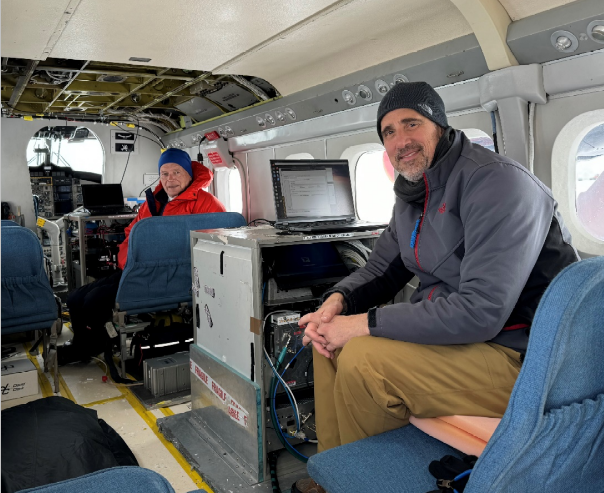
Instruments and Scientists Inside Cabin
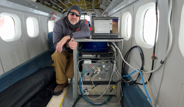
Radar Electronics Rack (bottom shows RDS electronics, middle Snow Radar, and top monitor/laptop)
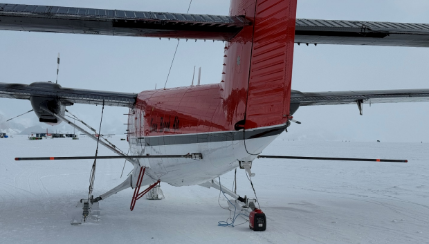
Long RDS dipole antenna through the KBA Twin Otter tail